2023/24
Bega Valley

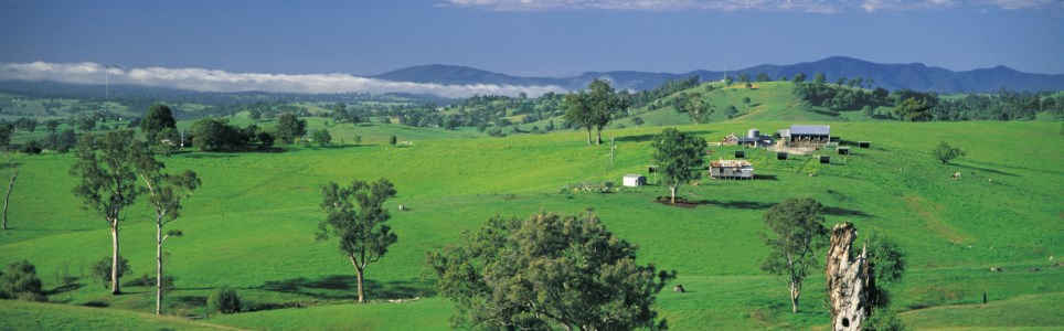
Bega Valley Shire is located at the south-eastern extremity of NSW. The Shire’s coastal fringe extends from Wallaga Lake in the north to Cape Howe and the Victorian boarder in the south and collectively this section of coastline forms the beautiful Sapphire Coast. Inland the higher peaks of the Great Dividing Range give way to rolling hills and numerous rivers and streams.

Data for this website has been sourced from Council’s financial statements, Council’s annual report and Council’s data returns. The website also refers to data from a number of agencies and entities. Please refer to the data page of this website for links to definitions, information on performance measures, benchmarks, OLG Groups and the data sources that have been used.

Please contact Council if you would like any further details or explanations regarding individual results and any differences between your Council’s performance and that of another council.

Contacting Council

Address:
Zingel Place
Bega NSW 2550
Postal Address:
PO Box 492, Bega NSW 2550
Phone: 02 6499 2222
Fax: 02 6499 2200

Your Local Government Area

Result
Population (No.) 36,593
Area (Km2) 6278.5
Council Classification Regional Town/City
OLG Group 4
State Planning Region South East and Tablelands
JO Region Canberra

Your Council

Result Group Avg. *
Councillors (No.) 9 10
Population per Councillor (No.) 4066 4294
Equivalent Full Time Staff (EFT) (No.) 348 390
2023/24 Revenue ($'000) 167852 162087
2023/24 Expenses ($'000) 134916 125153
Residential Pensioner Rebates (%) 21.67545401 17.58129015
Population Density (residents per Km2) 6 35.93
* A NSW council group is determined firstly by whether they are Urban or Rural in nature, and then by population size and density. Please refer to OLG Groups in data tab on website for more information on how individual councils are classified. An OLG group average is then calculated by the average of the same group number eg. All Group 5 Regional Towns/City or all Group 8 Rural.

Your Public Facilities

Result Group Avg.
Public Swimming Pool Complexes (inc rock pools) (No.) 8 3
Public Halls (No.) 17 14
Public Libraries (No.) 4 2.423076923
Open Public Space (ha) 826 773.9454423
Total Road Length (km) 1,534.33 1,416.15

Demographics of Population

under 20 years
20 - 59 years
60 years and older

Council population (%)

Group population (%)

5.2%

population change last 5 years

Source: ABS, Estimated Resident Population (ERP)

Your Local Population

Latest Outcome Group Avg.
Five Year Population Change (%) 5.229725026 3.931213689
Population aged under 20 years (%) 24.3 24.26114229
Population aged between 20 and 59 years (%) 47.1 47.14059365
Population aged 60 years and older (%) 28.6 28.59826406
Aboriginal & Torres Strait Islanders (%) 4.6 8.248152893
Speaks language other than English at home (%) 3.3 6.411538462
Socio-Economic Index Rank (1 low, 128 high) 54 60.11538462

Council Population Gender

Aboriginal & Torres
Strait Islander

Language Diversity

Rest of population

Your local population (%)


Your Local Economy

Result Group Avg.
Unemployment Rate (%) 3 2.907692308
Avg Taxable Income ($) 48494 58146.61538
Avg Household Size (No.) 2.2 2.419230769
Value of DA's determined ($'000) 110691 152649
Active Businesses in LGA (No.) 3376 3764.846154

Largest Industry Employer

Health care / Social